Zoning & Floodplain Administrator
Kristen Leahy
802-472-1686
zoning.administrator@hardwickvt.gov
Spring – Summer 2026 Office Hours
| The Planning and Zoning Office will be closed from March 27, 2026 through April 24, 2026 due to a Capital Improvement Project (Hip Replacement). The office will reopen on April 27, 2026. Thursday – 8:30 am to 2 pm Reopen on April 27, 2026 | |
NEWS
Zoning Office Update – Late March & April
A quick heads-up for anyone planning spring construction projects: the Zoning Office will be closed from March 27 through April 24 due to a scheduled medical leave.
Zoning applications will continue to be accepted during this time. Applications may be dropped off or mailed to the Town Manager’s Office during regular business hours.
During the closure, applications will be date-stamped and checked for fees and signatures, but no zoning review will occur until the office reopens.
Zoning review will resume on April 27, and applications will be reviewed in the order received. As in past seasons, permits are typically issued promptly once review begins.
Because this period overlaps with the start of the spring building season, applicants with time-sensitive projects are encouraged to plan ahead and submit complete applications in advance when possible.
For Zoning or Flood mitigation project emergencies – please contact the Town Manager’s office at 802-472-6120.
Thank you for your understanding.
—Kristen, Zoning Administrator
-
We’d love to hear from you!
The Town of Hardwick has started work on the 2027 update to our Municipal Plan, and the Planning Commission is asking for community input to help guide the process.
The Municipal Plan helps shape local decisions about things like housing, infrastructure, flood resilience, food systems, and community priorities over the next several years. Your input will help identify what people value most about Hardwick and what may need attention moving forward.
We’ve created a short community survey (about 5–8 minutes) and would love to hear from residents, workers, business owners, and anyone connected to Hardwick.
Take the survey here:
https://forms.gle/qDag6yeE487iTjQf6• Responses are anonymous
• You can skip any questions you prefer not to answer
• The survey is open through June 5Help Us Meet Our Goal of 300 Responses
Survey results will be summarized and shared publicly and will help inform the next Municipal Plan update.
Whether you’ve lived here your whole life or arrived more recently, your perspective helps shape Hardwick’s future.
If you would like a paper copy of the survey or need help completing it, please contact the Zoning Office at 802-472-1686 or the Town Manager’s office at 802-472-6120.
Thanks for participating!
-
REQUEST FOR PROPOSALS (RFP)
Engineering and Implementation Services
Confluence Floodplain Restoration ProjectTown of Hardwick, Vermont
The Town of Hardwick is seeking proposals from qualified engineering firms with experience in river restoration, floodplain reconnection, and flood mitigation for the Confluence Floodplain Restoration Project along the Lamoille River near downtown Hardwick.
Services will include site assessment, hydraulic and geomorphic analysis, engineering design, permitting coordination, and construction support. The selected consultant will coordinate with a separate Environmental Assessment consultant already retained by the Town.
This project is funded by the U.S. Department of Housing and Urban Development (HUD) Community Development Block Grant – Disaster Recovery (CDBG-DR) program.
The full RFP is available here: RFP – CDBG-DR IG
Proposals are due April 9, 2026 at 3:00 PM.
The Town of Hardwick is an Equal Opportunity Employer. Minority-owned, women-owned, and Section 3 businesses are encouraged to apply.
Questions may be directed to:
David Upson, Town Manager, at (802) 472-6120 or david.upson@hardwickvt.gov
Kristen Leahy, Resilience & Adaptation Coordinator, at (802)-472-1686 or zoning.administrator@hardwickvt.gov
Town of Hardwick, PO Box 523, Hardwick, VT 05843 -
REQUEST FOR QUALIFICATIONS (RFQ)
Engineering Services
Downtown Hardwick Flood Mitigation Scoping Study Town of Hardwick, VermontThe Town of Hardwick seeks Statements of Qualifications from qualified engineering or consulting firms to conduct a Lamoille Riverbank Stabilization and Flood Mitigation Study in downtown Hardwick. Work will include hydraulic and geomorphic analysis and development of conceptual engineering alternatives for riverbank stabilization and flood mitigation.
This project is funded by the U.S. Department of Housing and Urban Development (HUD) Community Development Block Grant – Disaster Recovery (CDBG-DR) program.
The full RFQ is available here: Request for Qualifications – CDBG-DR Planning
Qualifications are due April 9, 2026 at 3:00 PM.
The Town of Hardwick is an Equal Opportunity Employer. Minority-owned, women-owned, and Section 3 businesses are encouraged to apply.
Questions may be directed to:
David Upson, Town Manager, at (802) 472-6120 or david.upson@hardwickvt.gov
Kristen Leahy, Resilience & Adaptation Coordinator, at (802)-472-1686 or zoning.administrator@hardwickvt.gov
Town of Hardwick, PO Box 523, Hardwick, VT 05843 -
The Hardwick Select Board hereby provides notice of a public hearing being held pursuant to 24 VSA §4444 (Public Hearing Notice) for the purpose of hearing public comments concerning proposed changes to the Hardwick Unified Development Bylaws. The public hearing has been scheduled for March 19, 2026 (Thursday) at 5:00 p.m. on the third floor of the Memorial Building and by Zoom.
The meeting ID is 892 2336 5823.
To join the Zoom meeting: https://us06web.zoom.us/j/89223365823
Statement of Purpose:
The proposed changes to the Hardwick Unified Development Bylaws (known hereafter as “Bylaws”) will serve the following purposes:
- Align with state statutory requirements regarding dwelling units, including provisions enabling the conversion of hotels and motels into permanently affordable housing.
- Remove references to local Act 250 review in accordance with updated guidance under Act 181.
- Establish and implement a River Corridor Overlay District to protect floodplains and flood erosion areas.
- Create and integrate a new Village Center Zoning District for East Hardwick to support historic village character, housing opportunities, and pedestrian-oriented development.
Geographic Area Affected:
The Bylaw changes shall apply to all areas in the Town of Hardwick, Vermont.
Table of Contents:
Article 1: Authority and Purpose; Article 2: Zoning Districts; Article 3: General Regulations; Article 4: Specific Use Provisions; Article 5: Development Review; Article 6: Subdivision Review; Article 7: Administration and Enforcement; Article 8: Definitions.
Location Where Full Text May Be Examined:
The full context of the proposed changes can be viewed here or at the Hardwick Town Offices or on the Town of Hardwick website – www.hardwickvt.gov.
The meeting is open to the public. Interested people may attend the meeting in-person or on Zoom or send a letter or email to the Hardwick Select Board c/o the Zoning Administrator’s office to comment on the proposed update. Emails can be forwarded to the zoning.administrator@hardwickvt.gov address.
Hardwick Select Board
-
The Town of Hardwick is seeking proposals from qualified consulting or engineering firms to prepare a HUD-compliant Environmental Assessment (EA) for a floodplain restoration implementation project funded through a CDBG-DR grant.
The selected consultant must have demonstrated experience completing Environmental Assessments in accordance with 24 CFR Part 58, including NEPA compliance and coordination with state and federal agencies, and supporting projects through environmental clearance.
The project involves on-the-ground floodplain restoration within a previously disturbed footprint along the Lamoille River in downtown Hardwick and requires a full Environmental Assessment to support HUD approval and Authority to Use Grant Funds.
Firms with direct experience completing HUD Environmental Assessments for CDBG-DR or similar HUD-funded implementation projects are strongly encouraged to apply.
Click here for the complete RFP.
Proposals are due by: February 19, 2026
Questions may be directed to: David Upson, Town Manager, (802) 472-6120, david.upson@hardwickvt.gov -
The Town of Hardwick is looking for residents who are interested in serving on the Development Review Board.
The DRB reviews development proposals in public meetings and provides a place for neighbors to raise questions and understand how decisions are made before they happen.
After ten years of service, the current chair, John Mandeville, will be stepping down in June. New members are needed to continue this work and to bring a range of community perspectives to the Board.
DRB meetings are held as needed, typically on the 1st or 3rd Wednesday of the month. A hybrid option is available. Meetings generally last about one hour. There is no work requested outside of meetings.
No prior zoning or planning experience is required. Members receive support from the Zoning Office, including guidance on the applicable standards and the questions that need to be addressed during hearings.
If you have ever wondered how development decisions are reviewed, this is where that happens.
For more information or to express interest, please contact Kristen Leahy in the Zoning Office at (802) 472-1686 or zoning.administrator@hardwickvt.gov
PLANS & STUDIES
TOWN PLANS & STUDIES
Town Forest Recreation Plan – 2018
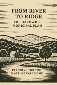
Hardwick Municipal Plan – 2019
Hardwick Municipal Plan Maps – 2019
Ecological Inventory – 2024
Enabling Better Places – A Zoning Guide for Vermont Neighborhoods – 2020 (State of Vermont)
Designated Downtown Map – 2023
South Main Street, Hardwick Audit – 2024
Original LVRT Loop Proposal Recommendations – Spring 2023
LVRT Loop Recommendations – 2024
Hardwick – LVRT Connector Loop Proposal by Local Motion – 2022
Updated Recommendations to the original Summer 2020 list – 2024
Landslide Inventory of Caledonia County Vermont (Includes Hardwick) – 2021
AARP WALKABILITY STUDIES (SIDEWALK REVIEWS)
South Main Street, Hardwick Walkability Audit from the Hardwick Planning Commission – 2024
Wolcott Street, Hardwick Walkability Audit from the Hardwick Planning Commission – 2024
Mill Street, Hardwick Walkability Audit from the Hardwick Planning Commission – 2021
Main Street, Hardwick Walkability Audit from the Hardwick Planning Commission – 2021
West Church Street, Hardwick Walkability Audit from the Hardwick Planning Commission – 2021
VHB – MILL STREET & MAIN STREET SCOPING STUDY – SUMMER/WINTER 2025
Local Concerns Meeting Flyer – Mill Street and Main Street – August 13, 2025
Concepts Presentation Invitation – Mill Street and Main Street – November 5, 2025
Presentation Slides for the November 5, 2025 Mill Street and Main Street Draft Concepts meeting
Overview of Concepts for November 5, 2025 Mill Street and Main Street scoping study presentation
HCTV recording link – 11-5-25
Overview of final plan from the January 7, 2026 Mill Street and Main Street scoping study
Next steps: A presentation to the Select Board will occur on February 5, 2026. A final Scoping Report is expected to be completed by February 2026. Over 80 residents, business owners, interested parties have submitted comments over the past 6 months.
COMMUNITY PLANNING FORUM (Bylaw Modernization Grant Process)
November 14, 2023 Community Planning Forum Slides
September 28, 2023 Community Planning Forum slides
WETLANDS
Lauren Sopher, MS., District Wetlands Ecologist in the Department of Environmental Conservation of the Vermont Agency of Natural Resources ~ 802-798-6634 ~ Lauren.Sopher@Vermont.gov
Lauren Sopher is the new contact for the Wetlands Program for Caledonia and Essex Counties. The Zoning Office has business cards for Lauren but we encourage you to request a site visit or a site review through the Wetland Inquiry Form. Additionally, here is a helpful snippet about how landowners and land buyers can check for wetlands:
- Check to identify if there is a wetland on property you are looking to purchase and develop. There are several ways that you can check for wetlands:
- Wetland Screening Tool: use this tool for the easiest and recommended way to see if a property has wetlands or to know if your plan may be affected by wetland laws.
- Identify wetlands on the ground: refer to our What is a Wetland? page with information on how to identify a wetland. Our Landowner’s Guide to Wetlands is a handy guide that includes a checklist to help spot a potential wetland or buffer zone on the ground.
- Check for Wetlands Before You Buy or Build educational campaign.
Visit the Wetlands Program website. Read frequently asked questions about wetlands.
Please note: by Vermont law, landowners and/or contractors are not allowed to disturb ground within 50 feet of an identified wetland without a wetland permit.
EMERGENCY PLANNING
Basic Emergency Operation Plans – Ongoing – external page
The Hardwick Plan – 2025 (Newest version of the Local Emergency Management Plan or the Basic Emergency Operations Plan)
The Volunteer Amendment to the Hardwick Plan – 2025
Local Hazard Mitigation Plan – 2023
EAP for East Long Pond/Nichols Pond/Mackville Pond – 2012
EAP for Mackville Pond Dam – 2016
EAST HARDWICK
East Hardwick Walk and Bike Safety Improvement concepts from Local Motion – 2022
East Hardwick Walkability Audit from the Hardwick Planning Commission – 2022
East Hardwick LVRT Trailhead Scoping Study – 2022
East Hardwick Designated Village Center Map – 2018
East Hardwick Fire District #1 – 2024 Source Protection Plan Update – 2024
Better Connections Final Report – 4-30-25 ~ Adopted in June 2025 by the Hardwick Select Board as an Addendum to the Hardwick Municipal Plan
Better Connections: Appendix 1 – List of Funding Sources
Better Connections: Appendix 2 – Market Study
Better Connections: Appendix 3 – Report on Community Outreach
Better Connections: Appendix 4 – Scoping Study for the LVRT Trailhead
Better Connections: Appendix 5 – Final Stormwater Treatment Report
Unified Development Bylaws – Also Known as the Zoning Regulations
Hardwick Unified Development Bylaws – adopted on September 5, 2024 (also known as the zoning and subdivision regulations).
Flood Safety Act Presentation on June 18, 2025 for the Community
Link to hearing recording: https://hctv.us/public-hearing-on-east-hardwick-zoning-bylaws-december-9-2025/
FAQs for the River Corridor Overlay
APPLICATIONS
HELPFUL REFERENCES
2025 Local Wastewater and Potable Water Designers
2025 Local Surveyors and Wetland Professionals
Factsheet about Renovations and Demolitions
Demolition and Renovation Activities information sheet
Low Risk Site Handbook for Erosion Prevention and Sediment Control – 2020
Vermont Residential Building Energy Code Handbook – 2024
Absorb the Storm: Create a Rain-friendly Yard and Neighborhood – 2010
The wetland screening tool was developed to help you navigate all the mapping layers which indicate a property may have wetlands on it. In addition to the Vermont Wetland Inventory Maps, the tool also screens for nearby hydric soils, wetland projects, wetland permits, wetland natural community types, and wetland advisory layers. To get started, all you need is the 911 address or the SPAN number for an undeveloped property. It is the best means of gaining a comprehensive view of potential wetlands on a property short of a site visit by a wetland professional, and understanding the layers you are looking at.
To request a site visit or a project review, please fill out this form. The form will be automatically emailed to your District Wetlands Ecologist for their processing. Please be patient for a response as they are typically in the field two days a week during the growing season.
ZONING APPLICATIONS
Hardwick Zoning Application for Permitted Use
For any permitted use outside of the Flood Hazard Area Overlay. This permit covers new construction, additions, or any other item which is permitted in your zoning district.
Hardwick Zoning Application for Subdivision
For any Subdivision Review Request. If you wish to subdivide your land, then this permit is for you.
Hardwick Agricultural Structural Exemption Notification
For Agricultural Exemptions Requests. Per Section 7.2 B; accepted agricultural and best management practices, including farm structures, are exempted from the permit requirements. However, written notification including a sketch plan of the structure showing setback distances from road rights-of-way, property lines, and surface waters shall be made to the Zoning Administrator prior to any construction. This document can be used to notify the ZA. Filing fee for this notification is $15 (recording fee). Please note that this exemption does not cover employee housing on a farm.
Hardwick Zoning Application for Signs
Specifically for a sign request. Calculation of Sign Area
Hardwick Demolition of Structures Notification
Notify us when you plan to demolish a structure. This notification has a $15 recording fee.
State of Vermont Asbestos Regulations – Demolition Requirements
Per Section 9.1 of the Vermont Regulations for Asbestos Control:
1. Inspection Requirement
- Before any demolition (full or partial) in Vermont, an inspection for asbestos-containing materials must be performed by a Vermont-licensed Asbestos Consulting Company.
- If asbestos is found, it must be removed by a Vermont-licensed Asbestos Abatement Company.
2. Demolition Notification Requirement
- Regardless of whether asbestos is found, a Notification of Demolition must be filed with the Vermont Department of Health at least 10 days prior to demolition.
- The notification must include the asbestos inspection results.
- These requirements apply to all buildings, regardless of age, type of construction, or demolition method.
3. Unsafe Structure Protocol
- If a building is unsafe to inspect or abate prior to demolition, the entire structure is presumed to contain asbestos.
- It must be demolished and disposed of as a permitted asbestos abatement project.
Resources
- Vermont Asbestos and Lead Licensing Portal
- Search for Vermont-licensed asbestos inspectors and abatement companies.
- Search by:
- Type: Company or RRPM Firm
- License Type: Asbestos Consulting Company
- Vermont Asbestos and Lead Licensing Portal
- Or https://vtalrp.imagetrendlicense.com/lms/public/portal#/lookup
- Vermont Building Demolition Notification Form
- Submit your required 10-day demolition notification online.
- You must attach your asbestos inspection results to the form.
- Vermont Building Demolition Notification Form
- Or https://survey.alchemer.com/s3/7079735/Vermont-Demolition-Notification
*DEC has created an online Permit Navigator to help answer state environmental permit questions. Permit Navigator | Department of Environmental Conservation (vermont.gov)
CONDITIONAL USE OR VARIANCE APPLICATIONS
Hardwick Zoning Application for Conditional Use
Specifically for Conditional Use or Variance. If you will need to visit the Development Review Board, then this permit is for you.
Hardwick Special Event – Conditional Use Application
DRIVEWAY PERMIT
Driveway Construction Approval Application
FLOOD HAZARD AREA OVERLAY DISTRICT APPLICATIONS
DEC has created an online Permit Navigator to help answer state environmental permit questions. Permit Navigator | Department of Environmental Conservation (vermont.gov)
Hardwick Zoning Application for Flood Hazard Administrative Permit
Specifically created for development in the Flood Hazard Area Overlay which would not require a zoning permit in other Zoning Districts. Examples include exterior and interior improvements, new parking areas, new or replacement fuel storage tanks for existing structures.
Hardwick Zoning Application for Flood Hazard Permitted Use
This application can be used for accessory structures (under 500 feet) in the Flood Hazard Area.
Hardwick Zoning Application for Conditional Use
Most activities in the Flood Hazard Area require a review from the Vermont Floodplain Manager and a Conditional Use review with the Development Review Board. Examples include new structures (even accessory structures over 500 square feet), substantial improvements to existing structures, grading, excavation, and road improvements.